


BOONE 03, Porter County, Indiana
About
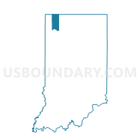
Outline

Summary
| Unique Area Identifier | 580106 |
| Name | BOONE 03 |
| County | Porter County |
| State | Indiana |
| Area (square miles) | 1.40 |
| Land Area (square miles) | 1.40 |
| Water Area (square miles) | 0.00 |
| % of Land Area | 100.00 |
| % of Water Area | 0.00 |
| Latitude of the Internal Point | 41.33733100 |
| Longtitude of the Internal Point | -87.20943950 |
Maps


Graphs
Select a template below for downloading or customizing gragh for BOONE 03, Porter County, Indiana


Neighbors
Neighoring Voting District (by Name) Neighboring Voting District on the Map
- BOONE 04, Porter County, IN
- BOONE 05, Porter County, IN
- PORTER 03, Porter County, IN
- WINFIELD TOWNSHIP PRECINCT 07, Lake County, IN
Top 10 Neighboring County Subdivision (by Population) Neighboring County Subdivision on the Map
- Winfield township, Lake County, IN (10,054)
- Porter township, Porter County, IN (9,367)
- Boone township, Porter County, IN (6,160)
Top 10 Neighboring Place (by Population) Neighboring Place on the Map
Top 10 Neighboring Unified School District (by Population) Neighboring Unified School District on the Map
- Crown Point Community School Corporation, IN (41,810)
- Porter Township School Corporation, IN (9,367)
- Boone Township Metropolitan School District, IN (6,160)
Top 10 Neighboring State Legislative District Lower Chamber (by Population) Neighboring State Legislative District Lower Chamber on the Map
Top 10 Neighboring State Legislative District Upper Chamber (by Population) Neighboring State Legislative District Upper Chamber on the Map
Top 10 Neighboring 111th Congressional District (by Population) Neighboring 111th Congressional District on the Map
Top 10 Neighboring Census Tract (by Population) Neighboring Census Tract on the Map
- Census Tract 433, Lake County, IN (10,054)
- Census Tract 510.07, Porter County, IN (7,157)
- Census Tract 511.01, Porter County, IN (6,160)
- Census Tract 510.08, Porter County, IN (2,210)